By Miranda Jackson
For The Diamondback
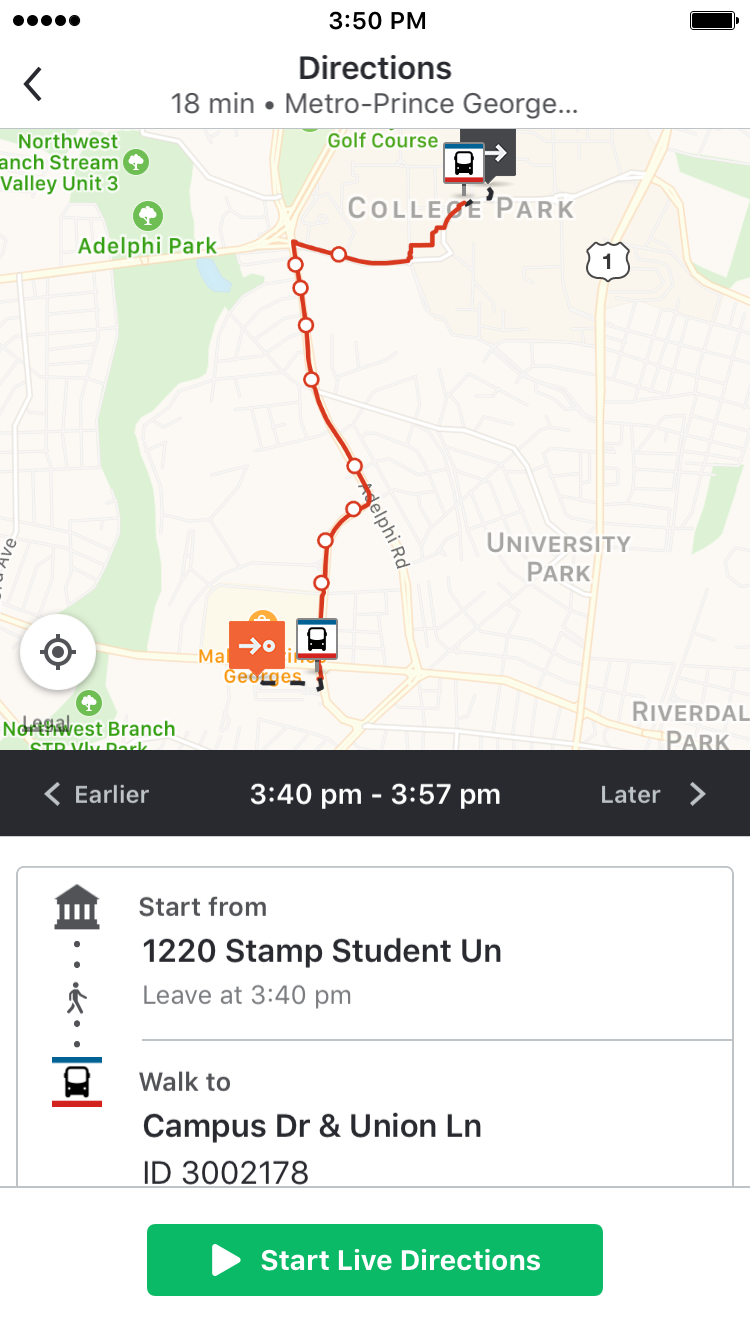
A group of University of Maryland students created routes of this university’s transportation systems for a transit app launching on the campus on Wednesday.
The Moovit app, which is available for both Android and iPhone devices, is free to download and use. The app uses information provided by Mooviters, individuals who offer to build transit paths within their own communities for the app.
Members of this university’s geography club partnered with Moovit as part of the app’s pilot program to work with various universities. About 20 students produced transit paths for the university community during a three-hour map-a-thon on Maryland Day, April 29.
David Klein, North American Country Manager for Moovit, contacted the geography club to bring the app to campus.
“We wanted to empower the student body to do this,” Klein said. “[These students] are obviously studying a lot in terms of geography. But being able to plot these lines … for people to then use in our app is just a great civic engagement.”
The app also offers transportation information for areas outside of the campus, including Metro and other transit routes, which were already highlighted in areas such as Washington, D.C.
Prior to the Maryland Day event, members of the geography student body were also invited to engage in a training session for contributing to the app, which offers scheduling information for any mode of transportation in the area, including buses, Metro, ferries and even bike shares, Klein said.
Shannon Corrigan, a graduate student studying international development, said she uses public transportation regularly, but finds it frustrating to have to check more than one app if she wants to know different systems’ transportation updates.
“It would be a lot easier to just open my phone and see — OK, it’ll be 10 minutes until the university shuttle comes, or I can catch the J-4 in three minutes,” said Corrigan, who also serves as board member of the geography club. “[Moovit] also gives you a better understanding of where the buses pick up because it’s actually put together by community members.”
In order to create Moovit routes, individuals sign up to be Mooviters and offer information on schedules, stops and lines for any mode of transportation, which is then screened for accuracy. That information is made live on the Moovit app.
Members of the geography club outlined the map of the Shuttle-UM system for Moovit using information available from this university’s Department of Transportation Services, as well as their personal knowledge of the routes.
In addition to mapping out these routes and the respective time frames for public transportation, the students also added the reduced service information for Maryland buses, which occurs on particular lines throughout holiday breaks.
Corrigan also said the club’s members added in time frames of the Shuttle-UM schedules, indicating the actual window students may have to catch a bus, as the buses don’t always run exactly on the official schedules.
Senior Zachary Mostowksy, a geographic information systems major, set up the path and stops for this university’s Green Line shuttle during the Maryland Day event.
Mostowksy said the plotting process “was very simple” and other contributors “wouldn’t have to be a geographic information systems major to do it”
“It was really fun working with other students to improve our transportation system here,” Mostowsky said.
The app is also able to help those with disabilities. Individuals with vision impairments can use the audio commands setting, and there are routes designed specifically for individuals in wheelchairs.
“The goal is to make sure everyone can access public transportation,” Klein said.