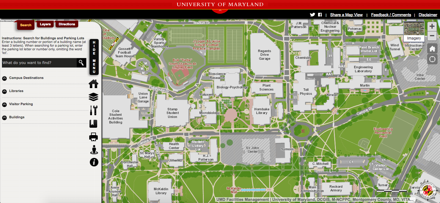
The University of Maryland’s Campus Maps app is getting an upgrade in the next few months to make it more accessible and user-friendly to students, staff and visitors who want to navigate the campus.
For more than three years, people have used the app — which is accessible on phone and desktop — to find campus buildings and get directions. The new improvements are set to be released in April before Maryland Day, which is April 29, said Taylor Keen, the Campus Geographic Information Systems coordinator.
The newest change to the app is a dynamic pedestrian routing feature, Keen said. People who use the app will be able to use their current locations on a map to get real-time directions to other parts of the campus.
“With this new method, it actually functions a lot like [the navigation feature on] Google Maps,” he said. “It detects your location from your phone, and then routes you to where you need to go.”
Unlike Google Maps, Campus Maps has campus-oriented information, such as campus bus stops and emergency phones, the option to search for dorms and academic buildings using their three-letter code, details about who can park in each parking lot and construction and renovation information about some of the buildings, according to the website.
[Read more: University of Maryland Web map overhaul brings interactive features, tours]
In addition to the enhanced directions between buildings, Keen said the GIS team is also planning to include directions to parking lots.
Campus Maps has seen a steady increase in users for two of the seven semesters it’s been in place, with no increase seen during the spring 2015 and spring 2016 semesters, according to data from Facilities Management. On the first day of the spring 2017 semester, there were about 12,000 sessions of activity on the site, and almost 9,000 unique users accessed the system. The first day of fall 2016 semester, there were less than 11,000 site visits and just under 8,000 unique users. In fall 2015, there were about 7,500 site visits and about 5,500 unique visitors.
Keen attributed the spike in visitors directly to another recent improvement to the app — the integration of Campus Maps and Testudo’s online schedule of classes during fall 2016 semester. When a user clicks on a building on the Testudo website, it provides them with a link to that building within the campus map, as well as its location and directions to it.
“The integration with the schedule of classes system is directly responsible for the surge of usage that we’ve seen,” Keen said. “[The integration] only happened last fall, but we really reaped the benefits of that this semester with everyone trying to find their classes.”
Gideon Epstein, a freshman government and politics major, was one of the 9,000 users at the beginning of this semester. While he didn’t think the program was perfect, he said it served its purpose by helping him find his classes.
“My one major concern with the app is that it didn’t help you navigate where you wanted to go [while you were walking] — it would just show you where a specific building was on campus, so these improvements … would make a big difference,” he said. The GIS team has since fixed that problem with its new update.
Keen noted feedback from students and other visitors is something the GIS team takes into consideration, and a group of undergraduate interns works with GIS to address responses and make necessary improvements. Fifty-eight Campus Services interns have worked on the application since 2012, he said.
Sam Powell worked on the application as an intern last summer and during the fall semester and believed “focusing on the details of the routing system” really improved the user experience, said the senior geographical sciences major, who is specializing in GIS and computer cartography.
[Read more: Student creates eco-friendly campus map]
GIS worked on updating pedestrian routes, because campus construction deemed some routes inaccessible, Powell said. It also evaluated the unconventional paths students normally take to ensure these routes were safe and handicap accessible.
Using Campus Maps has two main benefits: supporting the local GIS community and providing users with information specific to the campus, Powell said.
“We pay more attention to what students want or think about having,” he said. “We are more focused on the details that [University of Maryland] students would really benefit from, and that’s what makes us stand out.”
Staff writer Carly Taylor contributed to this report.
CORRECTION: Due to an editing error, a previous version of this story identified Sam Powell as a University of Maryland alumnus. He is a senior geographical sciences major focusing on GIS and computer cartography. This story has been updated.