Through the university’s urban studies and planning program, seven high school interns analyzed how walkable and safe College Park streets are.
The six-week program included students from Maryland, Washington and Ohio, and focused on assessing College Park streets through the use of Geographic Information System software, an online mapping and analysis tool.
“We went over GIS, taught them surveying skills and other mapping, urban planning and technology skills, as well as how to use Adobe Photoshop and Dreamweaver,” said Chelsie Miller, internship coordinator and an urban studies and planning graduate student.
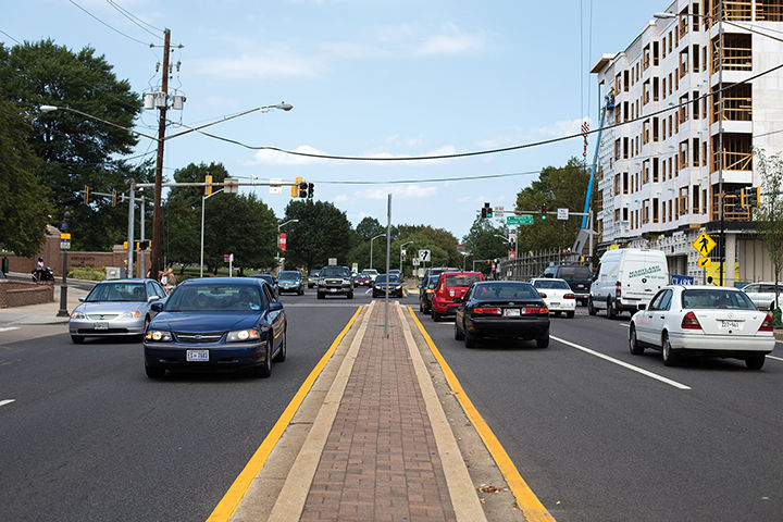
Participants in the High School GIS Internship Program used the tools to map out trees, utility poles and trash cans on each street and formed detailed legends that will be used to address College Park’s most pressing problem: pedestrian safety. Streets surveyed included Berwyn House Road, Edgewood Road, Berwyn Road, Hollywood Road, Cherokee Road and Fox Street.
Advisers evaluated the interns’ pictures for strengths, weaknesses and opportunities, said Alex Chen, the internship adviser and an urban studies and planning professor.
“We wanted to provide an internship where we taught technical skills to students … that not only met the needs of the center and the planning program, but also College Park,” Chen said.
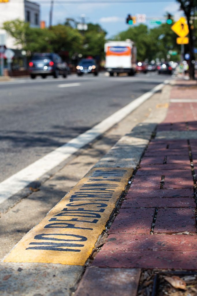
Intern Iko Esemoto, a senior at Springbrook High School in Silver Spring, created a website that features hyper-lapsed videos of the surveyed streets. The videos reveal poor conditions and missing sidewalks, indicating an unsafe walking environment.
Twenty-one and a half percent of roughly 31,000 city residents walk to work, according to the U.S. Census Bureau. The participants found 63 percent of the streets assessed in the study lacked access to sidewalks. All streets in the study lacked bike lanes.
“On [Hollywood Road], there is a park right off the street and it is very dangerous for kids,” Chen said. “There is no sidewalk.”
The interns also created a color-coded map with red-highlighted areas representing pedestrian- and cyclist-involved accidents that occurred between 2008 and 2012. The majority of accidents took place on or near the roads listed in the study, and most incidents occurred between Berwyn House Road and Navahoe Street.
The heavily trafficked area is home to several student rental houses and apartment complexes, such as University Club.
“It was never a problem getting to class, but having no sidewalks on my street didn’t help,” said senior kinesiology major Danny Adams, who lived on Pontiac Street last year.
At the end of the internship experience, the students presented their findings to the College Park Department of Planning and to Bill Gardiner, College Park’s assistant city manager and an urban studies and planning alumnus.
City planners and council members plan to use the data and assessments to improve the streets for College Park residents, Chen said.
“This internship helped me to realize how powerful and versatile GIS is as a tool for illustrating data,” Esemoto said. “It was very fulfilling to see that what we did was useful and will most likely lead to changes that will improve the safety of College Park.”